Web Design
Dawson Creek
Dawson Creek

Dawson Creek has a population of around 12,000 and became the regional centre in the 1930s when the western terminus of the Northern Alberta Railways (NAR) was established there.  The US Army used this rail terminus as a transhipment point during construction of the Alaska Highway.

The Visitor Centre, which is located in the NAR Railway Station Museum, was very helpful providing brochures, maps, accommodation guides along with the crucial “Campground & Gas Station Guide”.  This guide is essential as it indicates where the gas stations are and when they are open, I was travelling in early May and only about half the gas stations were open.  They have a web site here which offers a downloadable version of the guide though I would recommend checking with the Visitor Centre for last minute changes.

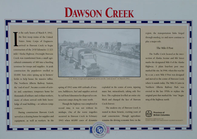
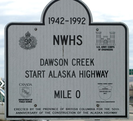
There are a number of signs and memorials close to the Visitor Centre, this one sets out the background to Dawson Creek.

DC00-IMGP4262
DC01-IMGP4270(R)

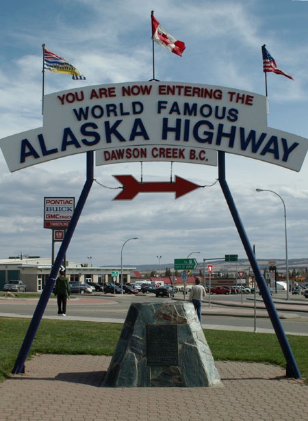
The Alaska Highway is never far from your thoughts when in Dawson Creek, possibly because everywhere you turn there is a sign relating to it.  This was the largest I saw.

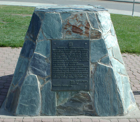
The stone plinth below the sign in the above photograph has a plaque dated August 1939  that predates the building of the Alaska Highway.  It records the Province of British Columbia’s recognition of the activities of the  Northern Woods and Water Route Association in providing access to the local scenery and recreational areas.

DC02-IMGP4265 (R)
DC03-IMGP4266

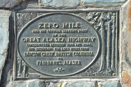
Another, and incorrect, sign marking Mile 0 (or Zero Mile) of the “Great Alaska Highway”.  The sign repeats a common error by claiming the Alaska Highway runs from Dawson Creek to Fairbanks AK.  It actually stops at Delta Junction, the remaining 95 miles to Fairbanks is the Richardson Highway.

Yet another “Mile 0” sign close to the ones shown above and also near to the Visitor Centre.

DC04-IMGP4268
DC05-IMGP4264(R)

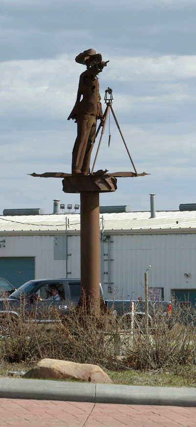
At the roundabout (or traffic circle) next to the Visitor Centre and the various signs shown above there is a metal statue that marks the beginning of the Alaska Highway.  The statue of a surveyor is pointing the way Northwest to Alaska.

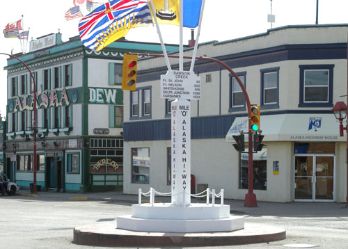
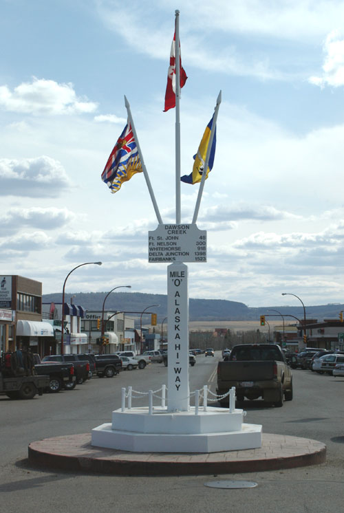
A more flamboyant  “Mile 0” post is located in the business district (just a couple of blocks away).  It is certainly safer to be photographed at that post than to go through the busy traffic (by local standards) to stand by the surveyor.


There are photographs of this “Mile 0” post below.


This photograph looks the mile post with The Historic Alaska Hotel that combined “the spirit of northern adventure with old world charm" in the background (I certainly enjoyed a drink there.  Unfortunately in September 2012 it went up in a blazing inferno.

DC06-IMGP4273

Another photograph of the “Mile 0” post looking down 10 Street.

DC07-IMGP4275(R)
DC08-IMGP4278(R)

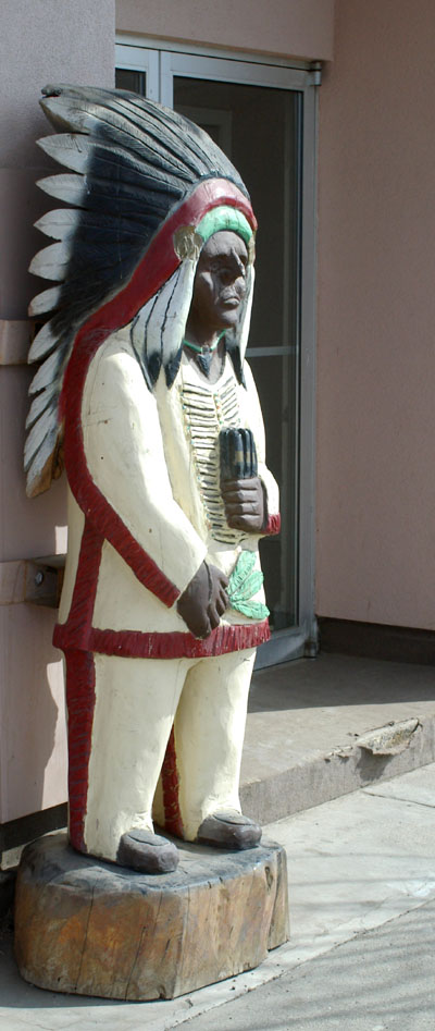
Also on 10 Street was this example of the rarely seen (these days) Cigar Store Indian.

There was a time when  such figures, in the likeness of an American Indian, were used to represent tobacconists.

The figures are often made as  three dimensional wooden sculptures several feet tall (they can be even larger than life size).

While they are still occasionally used for their original advertising purpose but are more often seen as decorations as was the case here.

[New Wildwood] [Contents] [Route 66] [Western Odyssey] [South East USA] [Round the World] [Why Wildwood?] [Site Status and News]